The worst places for flooding in the USA have been revealed … and many of them have a lot of homes built on flood plains.
The figures drill right down into US cities to reveal those at most risk of suffering from severe flooding … and Florida is deemed to be the most vulnerable.
The statistics have been compiled by the US company Groundworks which specialises in residential and commercial groundwork repair such as basements.
They reveal that in Florida 1.7 million people have flood insurance policies, which is about 22% of homeowners with the average flood insurance premium in Florida costing less than $500 per year. However, a 2ft flood in a one-story 2,500 square-foot home would cost about $87,326 in damage.
To understand the flood risk for each city, Groundworks has used data from New York University’s Furman Center which advances research and debate on housing, neighbourhoods and urban policy and then combined the National Flood Hazard Layer which has the latest flood hazard data with census data to calculate how many homes are at risk.
They then grouped together nearby metro areas that had high scores. In many cases, cities with high flood risk were clustered together.
So here are the worst metropolitan areas for flooding.
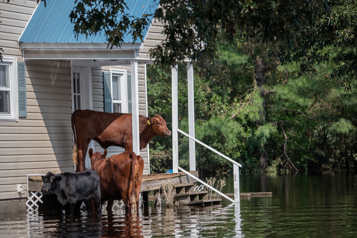
1 Fort Myers area of Florida
Punta Gorda, Florida
Naples, Florida
Fort Myers, Florida
2 Coastal Georgia
Brunswick
Savannah
Hinesville
3 Coastal Louisiana
Baton Rouge
Hammond
Lake Charles
Layfayette
4 Coastal Mississippi
Gulfport-Biloxi-Pascagoula
5 Florida Panhandle
Panama City
Crestview
6 Tampa area in Florida
Tampa
Homosassa Springs
Sarasota
7 San Joaquin Valley in California
Merced
Porterville
8 Coastal North Carolina
New Bern
Wilmington
9 Southern Atlantic Florida
Miami
Vero Beach
Port St Lucie
10 Chesapeake Bay Peninsula
Salisbury
11 Alabama Coast
Daphne-Fairhope-Foley
12 Inland Louisiana
Monroe
13 Cape Cod, Massachusetts
Barnstable Town
14 Central Texas
Abilene
Odessa
- Orlando area of Florida
Deltona
Orlando
Jackonsville
The Villages
Titusville
16 Virginia Beach Area
Virginia Beach-Norfolk-Newport News
Groundworks says that in the United States, the long-time standard for assessing flood risk is FEMA’s flood maps (https://www.fema.gov/flood-maps). The maps determine who needs flood insurance, inform local floodplain management and affect real estate decisions.
Some researchers argue that FEMA’s flood maps are flawed as risk measurements are calculated based on past floods and do not take into consideration future predictions of changing weather patterns. Estimates show that 66% to 80% of annual flood losses occur outside special hazard flood zones.
For instance, only 1% of homes in the New Orleans area are in a 100-year flood plain where the chance of a severe flood is one every century but during Hurricane Katrina in 2005 80% of the city was flooded after the levees and floodwalls failed.
Residents and business in areas prone to flooding need to make sure they are protected 24/7 from the risk of floods.
Many Americans use FloodSax® sandless sandbags to protect their homes and businesses from flooding. FloodSax® alternative sand bags are space-saving to store and easy to deploy. It means people have peace of mind and are ready for action 24/7 to prevent a flood.
FloodSax® are vacuum-packed and resemble a large pillowcase but once they come into contact with water they inflate to weigh 20kg (44lbs) which makes them more effective than traditional sandbags at keeping floodwater out. To find out more about FloodSax® click here.
More than 2.5 million FloodSax® have now been sold worldwide. To buy FloodSax® quickly in the US simply go to https://www.amazon.com/dp/B019C6C578/
To read the full Groundworks story go to https://www.groundworkscompanies.com/about/articles/16-worst-us-cities-for-flooding/